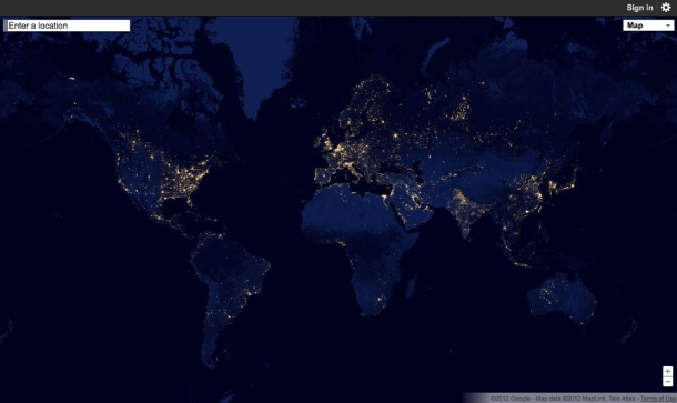
Google Maps now lets users take advantage of NASA’s cool ‘Black Marble’ feature that display a series of images showing what the Earth looks like from space once the sun sets. This feature is apart of Google’s new Earth at Night service, which the search giant announced today. The new service is a global view and animation of images taken from NASA and NOAA’s jointly operated Suomi NPP satellite.
Google in its announcement talked in detail about what Earth at Night brings to users, saying “It took 312 orbits to get a clear shot of every parcel of Earth’s land surface and islands.” The search giant added “This new data was then mapped over existing Blue Marble imagery of Earth to provide a realistic view of the planet.”
So in a nutshell, this interactive map by Google lets folks search from all over the world to see what different countries look like on the Black Marble imagery — displaying a vibrant glow from places like India, New York, Europe and China.
Who out there has used Google’s Earth at Night?
[Google+ page; via cnet]