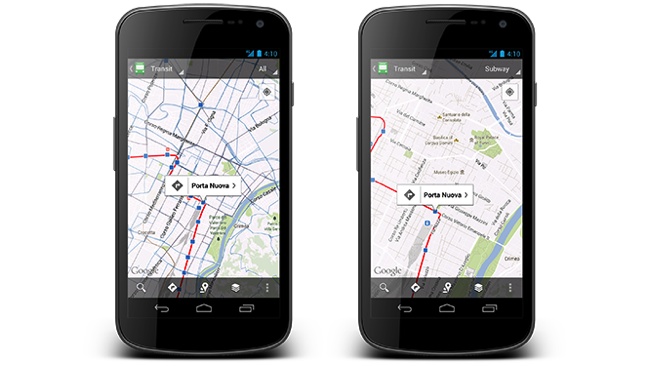
Folks who use public transportation for work or play will be pleasantly surprised with the latest Google Maps updates. The new version adds the schedule information for more than one million transits stops worldwide. The new information covers 500 major cities including New York, London, Tokyo and Sydney. The transit layer in the Maps app has also been updated and now lets you select a specific type of transportation like train, bus, tram or subway.
Besides changes to the transit features in the app, Google updated region highlighting so you see the borders of the region you are highlighting. It also improved My Places and Location History, so you can see where you are now and where you have been. The updated Google Maps is available from the Google Play store.
[Via Google]