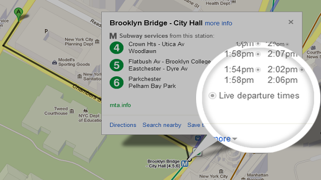
Users of public transit, rejoice! Your commute just gotten a whole lot easier. Google Maps Transit has been updated to reflect real-time arrival and departure of public transit systems in some U.S. cities today. Users of the service can now access public transportation information for seven lines in the New York City Subway (MTA) as well as busses and trams in the Salt Lake City Area (UTA). Washington D.C.’s Metrorail now has live service alerts, which include delays and track work.
Google Maps currently provides transit information for over 800 cities across 25 countries in the world, providing pick-up locations, departure times, estimated travel time and fare amounts. Google Maps is available for download on both iOS and Android platforms.
So if you reside in any of these areas, check out the new updates to Google’s excellent Maps app.
[Via: Google LatLong]